|
|
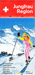
jungfrau.ch Jungfrau Ski Region Saison 2025/2026 1 Panoramakarte vierfarbig / panoramic map in four-color printing, 20 Abbildungen vierfarbig / illustrations in four-color printing, 51,7 x 27 cm, gefaltet auf / folded 5,7 x 9,2 cm, unter Kartonschutz / with cardboard cover 6,3 x 9,6 cm (deutscher und englischer Text / text in German and English) Faltblatt / leaflet herausgegeben von / published by |
|
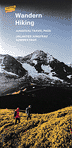
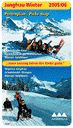
Wandern / Hiking Jungfrau Travel Pass - 15.12.2024-13.12.2025 Unlimited Jungfrau Summer Pass - 05.04.-30.11.2025 Panoramakarte Sommer der Bahnen im Jungfraugebiet / panoramic map summer of the railways of the Jungfrau Region, 60,5 x 42 cm, gefaltet auf / folded 10,2 x 21 cm (Rückseite mit 1 Panoramakarte, 16 Abbildungen vierfarbig und Text in Deutsch und Englisch / reverse with 1 panoramic map, 16 illustrations in four-color printing and with text in German and English Faltblatt / leaflet herausgegeben von den / published by the |
|
|
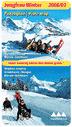
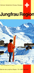
jungfrau.ch Jungfrau Ski Region Saison 2024/25 1 Panoramakarte vierfarbig / panoramic map in four-color printing, 17 Abbildungen vierfarbig / illustrations in four-color printing, 51,7 x 27 cm, gefaltet auf / folded 5,7 x 9,2 cm, unter Kartonschutz / with cardboard cover 6,3 x 9,6 cm (deutscher und englischer Text / text in German and English) Faltblatt / leaflet herausgegeben von / published by |
|
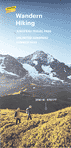
Wandern / Hiking Jungfrau Travel Pass - 29.3.-27.10.2024 Unlimited Jungfrau Summer Pass - 29.3.-1.12.2024 Panoramakarte Sommer der Bahnen im Jungfraugebiet / panoramic map summer of the railways of the Jungfrau Region, 60,5 x 42 cm, gefaltet auf / folded 10,2 x 21 cm (Rückseite mit 1 Panoramakarte, 37 Abbildungen vierfarbig und Text in Deutsch und Englisch / reverse with 1 panoramic map, 37 illustrations in four-color printing and with text in German and English Faltblatt / leaflet herausgegeben von den / published by the |
|
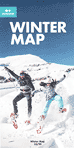
JBH / LSMS Winter Map 23/24 2 panoramic maps, 8 illustrations in four-color printing, 41,5 x 41,8 cm, folded 10,5 x 20,9 cm leaflet published by |
|
|
jungfrau.ch Jungfrau Ski Region Saison 2023/24 1 Panoramakarte vierfarbig / panoramic map in four-color printing, 17 Abbildungen vierfarbig / illustrations in four-color printing, 51,7 x 27 cm, gefaltet auf / folded 5,7 x 9,2 cm, unter Kartonschutz / with cardboard cover 6,3 x 9,6 cm (deutscher und englischer Text / text in German and English) Faltblatt / leaflet herausgegeben von / published by |
|
|
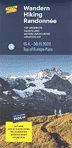
Wandern / Hiking / Randonnée Jungfrau Travel Pass - 7.4.-5.11.2023 Unlimited Jungfrau Summer Pass - 7.4.-30.11.2023 Panoramakarte Sommer der Bahnen im Jungfraugebiet / panoramic map summer of the railways of the Jungfrau Region, 60,5 x 42 cm, gefaltet auf / folded 10,2 x 21 cm (Rückseite mit 1 Panoramakarte, 36 Abbildungen vierfarbig und Text in Deutsch und Englisch / reverse with 1 panoramic map, 37 illustrations in four-color printing and with text in German and English Faltblatt / leaflet / dépliant herausgegeben von den / published by the |
|
Wandern / Hiking / Randonnée 15.4.-30.11.2022 / Top of Europe Pass Panoramakarte Sommer der Bahnen im Jungfraugebiet / panoramic map summer of the railways of the Jungfrau Region / carte panoramique d'été des chemins de fer Région de la Jungfrau, 60,6 x 42 cm, gefaltet auf / folded / plié 10,1 x 21 cm (Rückseite mit 1 Panoramakarte, 37 Abbildungen vierfarbig und Text in Deutsch, Englisch und Französisch / reverse with 1 panoramic map, 37 illustrations in four-color printing and with text in German, English and French / le verso avec 1 carte panoramique, 37 illustrations en couleurs et du texte en allemand, anglais et français) Faltblatt / leaflet / dépliant herausgegeben von den / published by the / publié par les |
|
Wandern / Hiking / Randonnée 17.4.-28.11.2021 / Top of Europe Pass Panoramakarte Sommer der Bahnen im Jungfraugebiet / panoramic map summer of the railways of the Jungfrau Region / carte panoramique d'été des chemins de fer Région de la Jungfrau, 60,6 x 42 cm, gefaltet auf / folded / plié 10,1 x 21 cm (Rückseite mit 1 Panoramakarte, 37 Abbildungen vierfarbig und Text in Deutsch, Englisch und Französisch / reverse with 1 panoramic map, 37 illustrations in four-color printing and with text in German, English and French / le verso avec 1 carte panoramique, 37 illustrations en couleurs et du texte en allemand, anglais et français) Faltblatt / leaflet / dépliant herausgegeben von den / published by the / publié par les |
|
Wandern / Hiking Mai - Oktober / Jungfrau Travel Pass Panoramakarte Sommer der Bahnen im Jungfraugebiet / carte panoramique d'été des chemins de fer Région de la Jungfrau / carta panoramica d'estate delle fertovie della Regione della Jungfrau / panoramic map summer of the railways of the Jungfrau Region, 60,6 x 42 cm, gefaltet auf / plié / piegato / folded 10,1 x 21 cm (Rückseite mit 2 Panoramakarten, 34 Abbildungen vierfarbig und Text in Deutsch, Französisch, Italienisch, Spanisch, Englisch und weitere fernöstliche Sprachen / le verso avec 2 cartes panoramiques, 34 illustrations en couleurs et du texte en allemand, français, italien, espagnol, anglais et en langues d'Extrême-Orient / il dorso con 2 carte panoramiche, 34 illustrazioni a quattro colori e con testo in tedesco, inglese, francese, italiano, spagnolo ed in lingue dell'Estremo Oriente / reverse with 2 panoramic maps, 34 illustrations in four-color printing and with text in German, French, Italian, Spanish, English and further Far Eastern languages) Faltblatt / dépliant / pieghevole / leaflet herausgegeben von den / publié par les / pubblicato delle / published by the |
|
|
jungfrau.ch Jungfrau Ski Region Top of Europe · Saison 2019/20 1 Panoramakarte vierfarbig / panoramic map in four-color printing, 17 Abbildungen vierfarbig / illustrations in four-color printing, 51,9 x 27 cm, gefaltet auf / folded 5,8 x 9 cm, unter Kartonschutz / with cardboard cover 6,3 x 9,6 cm (deutscher und englischer Text / text in German and English) Faltblatt / leaflet herausgegeben von / published by |
|
Wandern / Hiking Mai - Oktober / Jungfrau Travel Pass Panoramakarte Sommer der Bahnen im Jungfraugebiet / carte panoramique d'été des chemins de fer Région de la Jungfrau / carta panoramica d'estate delle fertovie della Regione della Jungfrau / panoramic map summer of the railways of the Jungfrau Region, 60 x 42 cm, gefaltet auf / plié / piegato / folded 10 x 21 cm (Rückseite mit 2 Panoramakarten, 18 Abbildungen vierfarbig und Text in Deutsch, Französisch, Italienisch, Spanisch, Englisch und weitere fernöstliche Sprachen / le verso avec 2 cartes panoramiques, 18 illustrations en couleurs et du texte en allemand, français, italien, espagnol, anglais et en langues d'Extrême-Orient / il dorso con 2 carte panoramiche, 18 illustrazioni a quattro colori e con testo in tedesco, inglese, francese, italiano, spagnolo ed in lingue dell'Estremo Oriente / reverse with 2 panoramic maps, 18 illustrations in four-color printing and with text in German, French, Italian, Spanish, English and further Far Eastern languages) Faltblatt / dépliant / pieghevole / leaflet herausgegeben von den / publié par les / pubblicato delle / published by the |
|
|
Wandern / Hiking Mai - Oktober / Jungfrau Travel Pass Panoramakarte Sommer der Bahnen im Jungfraugebiet / carte panoramique d'été des chemins de fer Région de la Jungfrau / carta panoramica d'estate delle fertovie della Regione della Jungfrau / panoramic map summer of the railways of the Jungfrau Region, 60 x 42 cm, gefaltet auf / plié / piegato / folded 10 x 21 cm (Rückseite mit 21 Abbildungen vierfarbig und Text in Deutsch, Französisch, Italienisch, Spanisch, Englisch und weitere fernöstliche Sprachen / le verso avec 21 illustrations en couleurs et du texte en allemand, français, italien, espagnol, anglais et en langues d'Extrême-Orient / il dorso con 21 illustrazioni a quattro colori e con testo in tedesco, inglese, francese, italiano, spagnolo ed in lingue dell'Estremo Oriente / reverse with 21 illustrations in four-color printing and with text in German, French, Italian, Spanish, English and further Far Eastern languages) Faltblatt / dépliant / pieghevole / leaflet herausgegeben von den / publié par les / pubblicato delle / published by the |
|
|
jungfrau.ch Jungfrau Ski Region Top of Europe · Saison 2017/18 1 Panoramakarte vierfarbig / panoramic map in four-color printing, 17 Abbildungen vierfarbig / illustrations in four-color printing, 51,9 x 27 cm, gefaltet auf / folded 5,7 x 9 cm, unter Kartonschutz / with cardboard cover 6,2 x 9,4 cm (deutscher und englischer Text / text in German and English) Faltblatt / leaflet herausgegeben von / published by |
|
Wandern / Hiking Mai - Oktober / Jungfrau Travel Pass Panoramakarte Sommer der Bahnen im Jungfraugebiet / carte panoramique d'été des chemins de fer Région de la Jungfrau / carta panoramica d'estate delle fertovie della Regione della Jungfrau / panoramic map summer of the railways of the Jungfrau Region, 60 x 42 cm, gefaltet auf / plié / piegato / folded 10 x 21 cm (Rückseite mit 21 Abbildungen vierfarbig und Text in Deutsch, Französisch, Italienisch, Spanisch, Englisch und weitere fernöstliche Sprachen / le verso avec 21 illustrations en couleurs et du texte en allemand, français, italien, espagnol, anglais et en langues d'Extrême-Orient / il dorso con 21 illustrazioni a quattro colori e con testo in tedesco, inglese, francese, italiano, spagnolo ed in lingue dell'Estremo Oriente / reverse with 21 illustrations in four-color printing and with text in German, French, Italian, Spanish, English and further Far Eastern languages) Faltblatt / dépliant / pieghevole / leaflet herausgegeben von den / publié par les / pubblicato delle / published by the |

|
Wandern / Hiking Mai - Oktober · Jungfraubahnen Pass Panoramakarte Sommer der Bahnen im Jungfraugebiet / carte panoramique d'été des chemins de fer Région de la Jungfrau / carta panoramica d'estate delle fertovie della Regione della Jungfrau / panoramic map summer of the railways of the Jungfrau Region, 60 x 42 cm, gefaltet auf / plié / piegato / folded 10 x 21 cm (Rückseite mit 19 Abbildungen vierfarbig und Text in Deutsch, Französisch, Italienisch, Spanisch, Englisch und weitere fernöstliche Sprachen / le verso avec 19 illustrations en couleurs et du texte en allemand, français, italien, espagnol, anglais et en langues d'Extrême-Orient / il dorso con 19 illustrazioni a quattro colori e con testo in tedesco, inglese, francese, italiano, spagnolo ed in lingue dell'Estremo Oriente / reverse with 19 illustrations in four-color printing and with text in German, French, Italian, Spanish, English and further Far Eastern languages) Faltblatt / dépliant / pieghevole / leaflet herausgegeben von den / publié par les / pubblicato delle / published by the |

|
Jungfraubahnen Pass Wandern | Hiking 1. Mai - 21. Oktober 2012 Panoramakarte Sommer der Bahnen im Jungfraugebiet / panoramic map summer of the railways of the Jungfrau Region / carte panoramique d'été des chemins de fer Région de la Jungfrau / carta panoramica d'estate delle fertovie della Regione della Jungfrau, 60 x 42 cm, gefaltet auf / folded / plié / piegato 10 x 21 cm (Rückseite mit 19 Abbildungen vierfarbig und Text in Deutsch, Französisch, Italienisch, Spanisch, Englisch und weitere fernöstliche Sprachen / le verso avec 19 illustrations en couleurs et du texte en allemand, français, italien, espagnol, anglais et en langues d'Extrême-Orient / il dorso con 19 illustrazioni a quattro colori e con testo in tedesco, inglese, francese, italiano, spagnolo ed in lingue dell'Estremo Oriente / reverse with 19 illustrations in four-color printing and with text in German, French, Italian, Spanish, English and further Far Eastern languages) Faltblatt / dépliant / pieghevole / leaflet herausgegeben von den / publié par les / pubblicato delle / published by the |

|
Jungfraubahnen Pass Wandern | Hiking wohi de süsch? 1. Mai - 31. Oktober Panoramakarte Sommer der Bahnen im Jungfraugebiet / panoramic map summer of the railways of the Jungfrau Region / carte panoramique d'été des chemins de fer Région de la Jungfrau / carta panoramica d'estate delle fertovie della Regione della Jungfrau, 59,9 x 42 cm, gefaltet auf / folded / plié / piegato 10,1 x 21 cm (Rückseite mit 19 Abbildungen vierfarbig und Text in Deutsch, Französisch, Italienisch, Spanisch, Englisch und weitere fernöstliche Sprachen / le verso avec 19 illustrations en couleurs et du texte en allemand, français, italien, espagnol, anglais et en langues d'Extrême-Orient / il dorso con 19 illustrazioni a quattro colori e con testo in tedesco, inglese, francese, italiano, spagnolo ed in lingue dell'Estremo Oriente / reverse with 19 illustrations in four-color printing and with text in German, French, Italian, Spanish, English and further Far Eastern languages) Faltblatt / dépliant / pieghevole / leaflet herausgegeben von den / publié par les / pubblicato delle / published by the |
|
Jungfraubahnen Pass Wandern | Hiking 1. Mai - 31. Oktober Panoramakarte Sommer der Bahnen im Jungfraugebiet / panoramic map summer of the railways of the Jungfrau Region / carte panoramique d'été des chemins de fer Région de la Jungfrau / carta panoramica d'estate delle fertovie della Regione della Jungfrau, 59,9 x 42 cm, gefaltet auf / folded / plié / piegato 10,1 x 21 cm (Rückseite mit 19 Abbildungen vierfarbig und Text in Deutsch, Französisch, Italienisch, Spanisch, Englisch und weitere fernöstliche Sprachen / le verso avec 19 illustrations en couleurs et du texte en allemand, français, italien, espagnol, anglais et en langues d'Extrême-Orient / il dorso con 19 illustrazioni a quattro colori e con testo in tedesco, inglese, francese, italiano, spagnolo ed in lingue dell'Estremo Oriente / reverse with 19 illustrations in four-color printing and with text in German, French, Italian, Spanish, English and further Far Eastern languages) Faltblatt / dépliant / pieghevole / leaflet herausgegeben von den / publié par les / pubblicato delle / published by the |
|
Bahnen der Jungfrau Region / Railways of the Jungfrau Region Jungfrau Winter 2009/10 Grindelwald-First / Kleine Scheidegg - Männlichen / Mürren - Schilthorn 1 Panoramakarte Winter vierfarbig / winter panoramic map in four-color printing, 7 Abbildungen vierfarbig / illustrations in four-color printing, 29,7 x 41,9 cm, gefaltet auf 10 x 21 cm deutscher und englischer Text / Text in German and English herausgegeben von den / published by the |
|
|
Bahnen der Jungfrau Region / Railways of the Jungfrau Region Jungfrau Winter 2008/09 Grindelwald-First / Kleine Scheidegg - Männlichen / Mürren - Schilthorn 1 Panoramakarte Winter vierfarbig / winter panoramic map in four-color printing, 7 Abbildungen vierfarbig / illustrations in four-color printing, 29,7 x 41,9 cm, gefaltet auf 10 x 21 cm deutscher und englischer Text / Text in German and English herausgegeben von den / published by the |
|
Jungfraubahnen Pass Wandern | Hiking 1. Mai - 31. Oktober Panoramakarte Sommer der Bahnen im Jungfraugebiet / panoramic map summer of the railways of the Jungfrau Region / carte panoramique d'été des chemins de fer Région de la Jungfrau / carta panoramica d'estate delle fertovie della Regione della Jungfrau, 60,6 x 42 cm, gefaltet auf / folded / plié / piegato 10,1 x 21 cm (Rückseite mit 18 Abbildungen vierfarbig und Text in Deutsch, Französisch, Italienisch, Spanisch, Englisch und weitere fernöstliche Sprachen / le verso avec 18 illustrations en couleurs et du texte en allemand, français, italien, espagnol, anglais et en langues d'Extrême-Orient / il dorso con 18 illustrazioni a quattro colori e con testo in tedesco, inglese, francese, italiano, spagnolo ed in lingue dell'Estremo Oriente / reverse with 18 illustrations in four-color printing and with text in German, French, Italian, Spanish, English and further Far Eastern languages) Faltblatt / dépliant / pieghevole / leaflet herausgegeben von den / publié par les / pubblicato delle / published by the |
|
Bahnen der Jungfrau Region / Railways of the Jungfrau Region Jungfrau Winter 2007/2008 Pistenplan | Piste map Grindelwald-First / Kleine Scheidegg - Männlichen / Mürren - Schilthorn 3 Panoramakarten Winter vierfarbig / winter panoramic maps in four-color printing, 13 Abbildungen vierfarbig / illustrations in four-color printing, 41,3 x 72 cm, gefaltet auf 10,4 x 18 cm deutscher und englischer Text / Text in German and English herausgegeben von den / published by the |
|
|
Jungfraubahnen Pass Wandern | Hiking 1. Mai - 31. Oktober Panoramakarte Sommer der Bahnen im Jungfraugebiet / panoramic map summer of the railways of the Jungfrau Region / carte panoramique d'été des chemins de fer Région de la Jungfrau / carta panoramica d'estate delle fertovie della Regione della Jungfrau, 60,6 x 42 cm, gefaltet auf / folded / plié / piegato 10,1 x 21 cm (Rückseite mit 18 Abbildungen vierfarbig und Text in Deutsch, Französisch, Italienisch, Spanisch, Englisch und weitere fernöstliche Sprachen / le verso avec 18 illustrations en couleurs et du texte en allemand, français, italien, espagnol, anglais et en langues d'Extrême-Orient / il dorso con 18 illustrazioni a quattro colori e con testo in tedesco, inglese, francese, italiano, spagnolo ed in lingue dell'Estremo Oriente / reverse with 18 illustrations in four-color printing and with text in German, French, Italian, Spanish, English and further Far Eastern languages) Faltblatt / dépliant / pieghevole / leaflet herausgegeben von den / publié par les / pubblicato delle / published by the |
|
Bahnen der Jungfrau Region / Railways of the Jungfrau Region Jungfrau Winter 2006/07 Pistenplan | Piste map Grindelwald-First / Kleine Scheidegg - Männlichen / Mürren - Schilthorn 3 Panoramakarten Winter vierfarbig / winter panoramic maps in four-color printing, 12 Abbildungen vierfarbig / illustrations in four-color printing, 40,8 x 71,9 cm, gefaltet auf 10,3 x 18 cm deutscher und englischer Text / Text in German and English herausgegeben von den / published by the |
|
|
Jungfraubahnen Pass Wandern | Hiking 1. Mai - 31. Oktober Panoramakarte Sommer der Bahnen im Jungfraugebiet / panoramic map summer of the railways of the Jungfrau Region / carte panoramique d'été des chemins de fer Région de la Jungfrau / carta panoramica d'estate delle fertovie della Regione della Jungfrau, 60,6 x 42 cm, gefaltet auf / folded / plié / piegato 10,1 x 21 cm (Rückseite mit 18 Abbildungen vierfarbig und Text in Deutsch, Französisch, Italienisch, Spanisch, Englisch und weitere fernöstliche Sprachen / le verso avec 18 illustrations en couleurs et du texte en allemand, français, italien, espagnol, anglais et en langues d'Extrême-Orient / il dorso con 18 illustrazioni a quattro colori e con testo in tedesco, inglese, francese, italiano, spagnolo ed in lingue dell'Estremo Oriente / reverse with 18 illustrations in four-color printing and with text in German, French, Italian, Spanish, English and further Far Eastern languages) Faltblatt / dépliant / pieghevole / leaflet herausgegeben von den / publié par les / pubblicato delle / published by the |
|
Bahnen der Jungfrau Region / Railways of the Jungfrau Region Jungfrau Winter 2005/2006 Pistenplan | Piste map Grindelwald-First / Kleine Scheidegg - Männlichen / Mürren - Schilthorn 3 Panoramakarten Winter vierfarbig / winter panoramic maps in four-color printing, 12 Abbildungen vierfarbig / illustrations in four-color printing, 41,3 x 72 cm, gefaltet auf 10,4 x 18 cm deutscher und englischer Text / Text in German and English herausgegeben von den / published by the |
|
|
Jungfraubahnen Pass Wandern | Hiking 1. Mai - 31. Oktober Panoramakarte Sommer der Bahnen im Jungfraugebiet / panoramic map summer of the railways of the Jungfrau Region / carte panoramique d'été des chemins de fer Région de la Jungfrau / carta panoramica d'estate delle fertovie della Regione della Jungfrau, 60,6 x 42 cm, gefaltet auf / folded / plié / piegato 10,1 x 21 cm (Rückseite mit 18 Abbildungen vierfarbig und Text in Deutsch, Französisch, Italienisch, Spanisch, Englisch und weitere fernöstliche Sprachen / le verso avec 18 illustrations en couleurs et du texte en allemand, français, italien, espagnol, anglais et en langues d'Extrême-Orient / il dorso con 18 illustrazioni a quattro colori e con testo in tedesco, inglese, francese, italiano, spagnolo ed in lingue dell'Estremo Oriente / reverse with 18 illustrations in four-color printing and with text in German, French, Italian, Spanish, English and further Far Eastern languages) Faltblatt / dépliant / pieghevole / leaflet herausgegeben von den / publié par les / pubblicato delle / published by the |
|
|
Jungfraubahnen Pass Wandern | Hiking 1. Mai - 31. Oktober Panoramakarte Sommer der Bahnen im Jungfraugebiet / panoramic map summer of the railways of the Jungfrau Region / carte panoramique d'été des chemins de fer Région de la Jungfrau / carta panoramica d'estate delle fertovie della Regione della Jungfrau, 60,6 x 42 cm, gefaltet auf / folded / plié / piegato 10,1 x 21 cm (weißer Text / white text / texte blanc / testo bianco "Jungfrau Region Switzerland"; Rückseite mit 18 Abbildungen vierfarbig und Text in Deutsch, Französisch, Italienisch, Spanisch, Englisch und weitere fernöstliche Sprachen / le verso avec 18 illustrations en couleurs et du texte en allemand, français, italien, espagnol, anglais et en langues d'Extrême-Orient / il dorso con 18 illustrazioni a quattro colori e con testo in tedesco, inglese, francese, italiano, spagnolo ed in lingue dell'Estremo Oriente / reverse with 18 illustrations in four-color printing and with text in German, French, Italian, Spanish, English and further Far Eastern languages) Faltblatt / dépliant / pieghevole / leaflet herausgegeben von den / publié par les / pubblicato delle / published by the |
|
Jungfraubahnen Pass Wandern | Hiking 1. Mai - 31. Oktober Panoramakarte Sommer der Bahnen im Jungfraugebiet / panoramic map summer of the railways of the Jungfrau Region / carte panoramique d'été des chemins de fer Région de la Jungfrau / carta panoramica d'estate delle fertovie della Regione della Jungfrau, 60,6 x 42 cm, gefaltet auf / folded / plié / piegato 10,1 x 21 cm (blauer Text / blue text / texte bleu / testo blu "Jungfrau Region Switzerland"; Rückseite mit 18 Abbildungen vierfarbig und Text in Deutsch, Französisch, Italienisch, Spanisch, Englisch und weitere fernöstliche Sprachen / le verso avec 18 illustrations en couleurs et du texte en allemand, français, italien, espagnol, anglais et en langues d'Extrême-Orient / il dorso con 18 illustrazioni a quattro colori e con testo in tedesco, inglese, francese, italiano, spagnolo ed in lingue dell'Estremo Oriente / reverse with 18 illustrations in four-color printing and with text in German, French, Italian, Spanish, English and further Far Eastern languages) Faltblatt / dépliant / pieghevole / leaflet herausgegeben von den / publié par les / pubblicato delle / published by the |
|
Jungfraubahnen Pass Wandern 1. Mai - 31. Oktober Panoramakarte Sommer der Bahnen im Jungfraugebiet / panoramic map summer of the railways of the Jungfrau Region / carte panoramique d'été des chemins de fer Région de la Jungfrau / carta panoramica d'estate delle fertovie della Regione della Jungfrau, 60,6 x 42 cm, gefaltet auf / folded / plié / piegato 10,1 x 21 cm (Rückseite mit 18 Abbildungen vierfarbig und Text in Deutsch, Französisch, Italienisch, Spanisch, Englisch und weitere fernöstliche Sprachen / le verso avec 18 illustrations en couleurs et du texte en allemand, français, italien, espagnol, anglais et en langues d'Extrême-Orient / il dorso con 18 illustrazioni a quattro colori e con testo in tedesco, inglese, francese, italiano, spagnolo ed in lingue dell'Estremo Oriente / reverse with 18 illustrations in four-color printing and with text in German, French, Italian, Spanish, English and further Far Eastern languages) Faltblatt / dépliant / pieghevole / leaflet herausgegeben von den / publié par les / pubblicato delle / published by the |
|
Jungfraubahnen Jungfrau Region Panoramakarte mit Wander- und Mountain-Bike-Routen ohne Maßstab, 67,7 x 56,542 cm, gefaltet auf 11,4 x 19 cm (auf der Rückseite Wandervorschläge und 5 Abbildungen vierfarbig) erschienen bei Skorpion Marketing GmbH, Ennetmoos, ohne Jahresangabe (um 2004) |
|
JB / GGM / LWM Kleine Scheidegg / Männlichen 2000/2001 Grindelwald Wengen & Lauberhorn 1 Panoramakarte Winter vierfarbig / winter panoramic map in four-color printing / carte panoramique d'hiver en couleurs, 29.7 x 42 cm, gefaltet auf 10 x 21 cm (auf der Rückseite Informationen und 3 Abbildungen vierfarbig / reverse with information and 9 illustrations in four-color printing / le verso avec des informations et 3 illustrations en couleurs) deutscher, englischer und französischer Text / Text in German, English and French / intégralité du texte trilingue: allemand/anglais/français ohne angabe eines Herausgebers / without mentioning any editor / sans mention d'un éditeur wahrscheinlich herausgegeben von den / probablement publié par les / probably published by the |
|
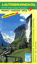
Lauterbrunnental Exkursions-Panorama (Vogelschaukarte Sommer) vierfarbig / Carte à vol d'oiseau d'été en couleurs / Aerial Map Summer in four-color printing ohne Maßstab / sans échelle / without a scale, 63 x 36 cm, gefaltet auf / plié / folded 10,5 x 18 cm (auf der Rückseite Panorama Winter, 8 Abbildungen vierfarbig und Wandervorschläge / au verso avec une carte panoramique d'hiver, 8 illustrations en couleurs et des propositions des randonnées / reverse with winter panoramic map, 8 illustrations in four-color printing and hiking proposals) Faltblatt / dépliant / leaflet herausgegeben vom / publié par / published by |
|
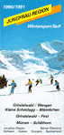
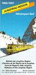
Bahnen der Jungfrau Region / Chemins de fer Région de la Jungfrau / Ferrovie Regione della Jungfrau / Railways of the Jungfrau Region Jungfrau Region 1990/1991 / Wintersport-Tarif Grindelwald / Wengen / Kleine Scheidegg - Männlichen / Grindelwald - First / Mürren - Schilthorn 1 Panoramakarte Winter vierfarbig / carte panoramique d'hiver en couleurs / winter panoramic map in four-color printing, 59,9 x 42 cm, gefaltet auf 10,1 x 21 cm (auf der Rückseite Informationen und 3 Abbildungen vierfarbig / le verso avec des informations et 3 illustrations en couleurs / reverse with information and 3 illustrations in four-color printing) deutscher, französischer und englischer Text / intégralité du texte trilingue: allemand/français/anglais / Text in German, French and English herausgegeben von den / publié par les / published by the |
|
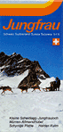
Jungfraubahnen Jungfrau Kleine Scheidegg-Jungfraujoch / Mürren-Allmendhubel / Schynige Platte / Harder Kulm Panoramakarte der Bahnen im Jungfraugebiet ohne Maßstab, 60 x 42 cm, gefaltet auf 10 x 21 cm (auf der Rückseite 18 Abbildungen vierfarbig) herausgegeben von den |
|
Bahnen der Jungfrauregion Jungfrau Region Interlaken / Grindelwald / Lauterbrunnen / Mürren / Wengen / Wilderswil Panoramakarte der Bahnen im Jungfraugebiet ohne Maßstab, 59,8 x 42 cm, gefaltet auf 10 x 21 cm (auf der Rückseite 18 Abbildungen vierfarbig) herausgegeben von den |
|
BGF Bergbahnen Grindelwald First Wanderkarte Grindelwald-First 1 topografische Karte ohne Maßstabsangabe, 30 Abbildungen vierfarbig, 62,1 x 14,7 cm, gefaltet auf 10,5 x 14,7 cm herausgegeben von den |
|
Bahnen der Jungfrauregion Jungfrau Region Grindelwald / Interlaken / Lauterbrunnen / Mürren / Wengen / Wilderswil Panoramakarte Winter der Bahnen im Jungfraugebiet ohne Maßstab, 59,9 x 42 cm, gefaltet auf 10 x 21 cm (auf der Rückseite 23 Abbildungen vierfarbig) herausgegeben von den |
|
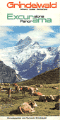
Grindelwald Excursions Panorama Panoramakarte vierfarbig / Carte panoramique en couleurs / Panoramic map in four-color printing ohne Maßstab / sans échelle / without a scale, 106,6 x 24 cm, gefaltet auf / plié / folded 12 x 24 cm (auf der Rückseite "Spaziergänge und Ausflüge von Grindelwald" / au verso "Petit guide du promeneur" / reverse "Walks around Grindelwald") Faltblatt / dépliant / leaflet herausgegeben vom / publié par / published by |
|
Bahnen der Jungfrau-Region Jungfrau Region Panoramakarte Winter der Bahnen im Jungfraugebiet / panoramic map winter of the railways of the Jungfrau Region / carte panoramique d'hiver des chemins de fer Région de la Jungfrau / carta panoramica d'inverno delle fertovie della Regione della Jungfrau ohne Maßstab, 50 x 42 cm, gefaltet auf / folded / plié / piegato 10 x 21 cm (Legende und Text auf der Rückseite in Deutsch, Englisch, Französisch und Italienisch / legend and reverse with text in German, English, French and Italian / la legende et le verso avec du texte en allemand, anglais, français et italien / legenda ed il dorso con testo in tedesco, inglese, francese ed italiano) (auf der Rückseite 13 Abbildungen vierfarbig / reverse with 13 illustrations in four-color printing / le verso avec 13 illustrations en couleurs / il dorso con 13 illustrazioni a quattro colori) Faltblatt / leaflet / dépliant / pieghevole herausgegeben von den / published by / publié par / pubblicato delle |
|
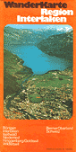
Wanderkarte Region Interlaken Bönigen Interlaken Iseltwald Niederried Ringgenberg/Goldswil Wilderswil 1 Wanderkarte und 1 Panoramakarte vierfarbig / 1 carte de promenades et 1 carte panoramique en couleurs / 1 hiking map and 1 panoramic map in four-color printing ohne Maßstab / sans échelle / without a scale, 60 x 47,8 cm, gefaltet auf / plié / folded 12 x 23,9 cm (auf der Rückseite "Spaziergänge und Ausflüge von Grindelwald" / au verso "Petit guide du promeneur" / reverse "Walks around Grindelwald") Faltblatt / dépliant / leaflet herausgegeben vom / publié par / published by |
|
Bahnen der Jungfrauregion Jungfrau Region Panoramakarte Winter der Bahnen im Jungfraugebiet ohne Maßstab, 49,8 x 42 cm, gefaltet auf 10 x 21 cm (Legende in Deutsch, Englisch, Französisch und Italienisch / legend in German, English, French and Italian / legende en allemand, anglais, français et italien / legenda in tedesco, inglese, francese ed italiano) (auf der Rückseite 16 Abbildungen vierfarbig / reverse with 16 illustrations in four-color printing / le verso avec 16illustrations en couleurs / il retro con 16 illustrazioni a quattro colori) herausgegeben von den / published by / publié par / pubblicato delle |
|
WAB/JB Jungfrau Panorama Map of Jungfrau Region Railways without scale, 49,7 x 41,9 cm, folded 10 x 21 cm (reverse with English text, 13 illustrations in four-color printing) published by |
|
WAB/JB Jungfrau Panoramakarte der Bahnen im Jungfraugebiet ohne Maßstab, 49,8 x 41,9 cm, gefaltet auf 10 x 21 cm (auf der Rückseite Texte in deutsch, franzözisch, englisch, italienisch, niederländisch und spanisch, 12 Abbildungen vierfarbig) herausgegeben von der |
|
Bahnen der Jungfrauregion Jungfrau Region Panoramakarte Sommer der Bahnen im Jungfraugebiet ohne Maßstab, 49,8 x 42 cm, gefaltet auf 10 x 21 cm (Legende in Deutsch, Englisch, Französisch und Italienisch / legend in German, English, French and Italian / legende en allemand, anglais, français et italien / legenda in tedesco, inglese, francese ed italiano) (auf der Rückseite 20 Abbildungen vierfarbig) herausgegeben von den / published by / publié par / pubblicato delle |
|
WAB/JB Jungfrau Region Panoramakarte Sommer der Bahnen im Jungfraugebiet ohne Maßstab, 49,8 x 42 cm, gefaltet auf 10 x 21 cm (Legende in Deutsch, Englisch, Französisch und Italienisch / legend in German, English, French and Italian / legende en allemand, anglais, français et italien / legenda in tedesco, inglese, francese ed italiano) (auf der Rückseite 20 Abbildungen vierfarbig) herausgegeben von den / published by / publié par / pubblicato delle |
|
WAB/JB Kleine Scheidegg / Jungfraujoch Panoramakarte der Bahnen im Jungfraugebiet ohne Maßstab, 41,8 x 42 cm, gefaltet auf 10,5 x 21 cm (auf der Rückseite Texte in deutsch, franzözisch, englisch, italienisch, niederländisch und spanisch, 12 Abbildungen vierfarbig) herausgegeben von der |
|
WAB/JB Jungfraujoch / Jungfraubahn Panoramakarte der Bahnen im Jungfraugebiet ohne Maßstab, 41,8 x 34 cm, gefaltet auf 10,5 x 21 cm (auf der Rückseite Texte in deutscher Sprache, 12 Abbildungen vierfarbig) herausgegeben von der |